Jump to:
Distance & Angle
Tolerance settings
Atmospheric unit settings
Distance & Angle
- To configure the units settings for Distance and Angle, go to Settings > Units & Tolerances from within the Home screen/Admin Panel.
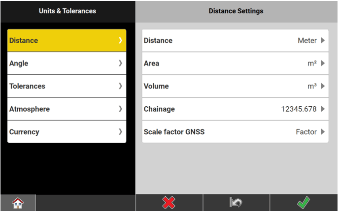
- Distance is selected by default.
- Unit Options:
- For Distance select from Meter, US Survey Feet Fractional, US Survey Feet Decimal, Feet Fractional, or Feet Decimals.
- For Area select from m², Hectare, US ft², US Acres, Int ft², or Int Acres.
- For Volume select from m³, Int ft³, US ft³, or yd³.
- For Chainage select one of the predefined settings.
- For Scale factor GNSS select between Factor and ppm or mm/km.
- Tap
 to save changes.
- Select Angle.
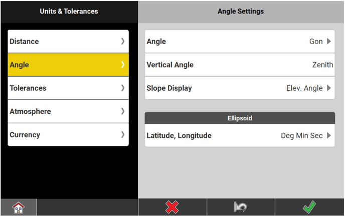
- Angle Options:
- For Angle select from Gon, Deg Min Sec, or Deg Dec.
- For Vertical Angle the sole setting is Zenith.
- For Slope Display select from H:V, V:H, %, or Elev. Angle.
- For Latitude, Longitude select between Deg Min Sec or Deg Dec.
- Tap to save changes.
Tolerance Settings
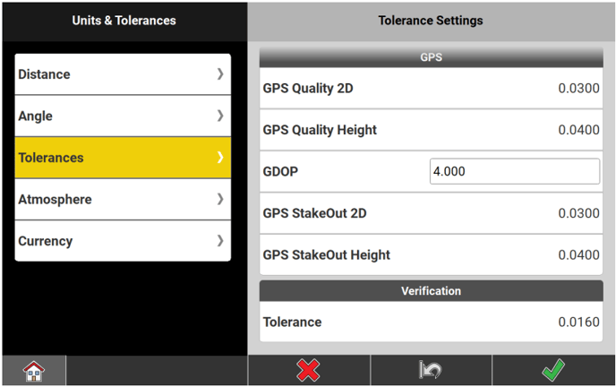
- To configure the settings for tolerances, go to Settings > Units & Tolerances from within the Home screen/Admin Panel.
- Select Tolerances.
- The screen contains tolerance settings for Total Station and GPS.
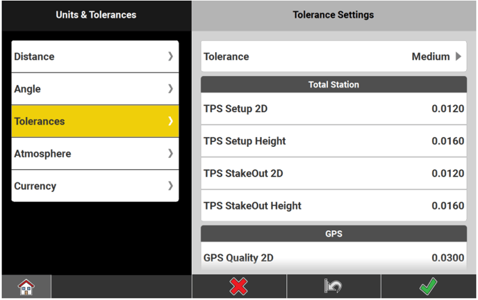
- The tolerance setting for Verification report is only available with the respective licence.
- The screen contains tolerance settings for Total Station and GPS.
- In the Tolerance Settings screen, define the Tolerance level.
Select from three predefined tolerance sets:- Tolerant
- Medium
- Precise
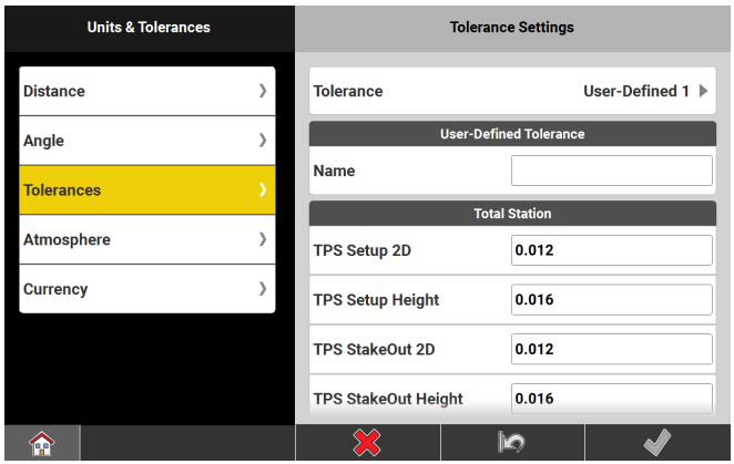
- Or select a user-defined tolerance set.
- Tap to save changes.
-
-
- Tap one of the relevant icons.
- Give the tolerance set the desired name.
- Enter the desired tolerance values for Total Station and GPS.
Both values must be set! By default the Medium values are set. - When finished tap to confirm.
- Up to ten user-defined tolerances can be stored.
-
Adopted tolerance values differ according to the connected instrument, and the active application:
| Tolerance level | |||
| Tolerant | Medium | Precise | |
| Total Station | |||
| TPS Setup 2D | 0.0300 m | 0.0120 m | 0.0030 m |
| TPS Setup Height | 0.0400 m | 0.0160 m | 0.0040 m |
| TPS StakeOut 2D | 0.0600 m | 0.0120 m | 0.0060 m |
| TPS StakeOut Height | 0.0800 m | 0.0160 m | 0.0080 m |
| GPS | |||
| GPS Quality 2D | 0.0600 m | 0.0300 m | 0.0150 m |
| GPS Quality Height | 0.0800 m | 0.0400 m | 0.0200 m |
| GDOP | 5.0 | 4.0 | 3.0 |
| GPS StakeOut 2D | 0.0600 m | 0.0300 m | 0.0150 m |
| GPS StakeOut Height | 0.0800 m | 0.0400 m | 0.0200 m |
| Verification | 0.0800 m | 0.0160 m | 0.0080 m |
Atmospheric unit settings
- To configure the settings for atmospheric units, go to Settings > Units & Tolerances from within the Home screen/Admin Panel.
- Select Atmosphere.
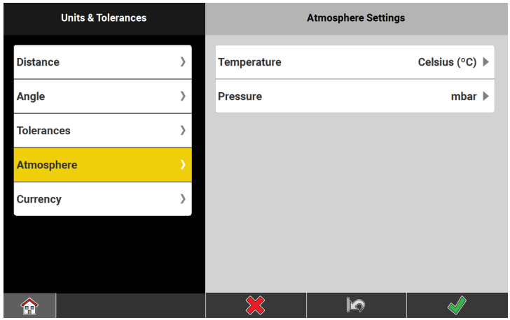
- In the Atmosphere Settings screen, set the units for Temperature and Pressure.
- For Temperature select between Celsius (ºC) and Fahrenheit (ºF).
- For Pressure select from mbar, mmHg and inHg.
- Tap to save changes.