Description
| Type/Icon | Description |
|
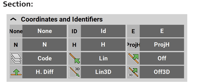
Id
|
Point ID of the current point to record. |
|
E
|
East value at the current target position. |
|
N
|
North value at the current target position. |
|
H
|
Height at the current target position. |
|
ProjH
|
A value set during project creation to define a height shift for measured points in the project. |
|
Code
|
Code/layer for the next point to record. |
|
Lin
|
Horizontal line value (2D) from the measured point along the selected line. |
|
Off
|
Offset value at measured point to the selected line (2D). |
|
H. Diff
|
Height difference, from the measurement position to the start of the control line. Or with a reference line selected, from the measurement position to the start of the reference line. |
|
Lin3D
|
3D line value from the measured point along the selected line. |
|
Off3D
|
3D offset value at measured point to the selected line. |


| Type/Icon | Description |
|
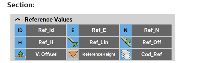
Ref_Id
|
Reference ID of the stakeout/layout element. |
|
Ref_E
|
East value of the stakeout/layout point. |
|
Ref_N
|
North value of the stakeout/layout point. |
|
Ref_H
|
Height of the stakeout/layout point. |
|
Ref_Lin
|
Line value of the stakeout/layout point, along the selected reference line. |
|
Ref_Off
|
Offset value of the stakeout/layout point, to the selected reference line. |
|
VOff
|
Vertical offset value of the defined reference surface. |
|
Reference Height
|
Reference height for staking out, that is defined by entering a value or selecting a point or surface. |
|
Cod_Ref
|
Code of the reference point. |


| Type/Icon | Description |
|
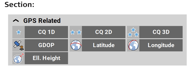
CQ 1D
|
Coordinate quality value for the height information at the current position. |
|
CQ 2D
|
Coordinate quality values for the plain information at the current position. |
|
CQ 3D
|
Coordinate quality values for a combination of the height and the plain information at the current position. |
|
GDOP
|
Geometric dilution of precision quality value at the current position. |
|
Latitude
|
Global coordinate to define the north-south position of a point. |
|
Longitude
|
Global coordinate to define the east-west position of a point. |
|
Ell. Height
|
Global coordinate to define the ellipsoidal height of a point. |



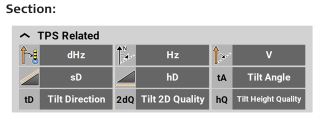
| Type/Icon | Description |
|
dHz
|
TPS only: Horizontal angle between the current line of sight and the stakeout/layout point. |
|
Hz
|
Horizontal angle to the current target position. |
|
V
|
Vertical/zenith angle to the current target position. |
|
sD
|
Slope distance to the last point measured. |
|
hD
|
Horizontal distance to the last point measured. |
|
Tilt Angle
|
When using AutoPole: Tilt angle of pole. |
|
Tilt Direction
|
When using AutoPole: Direction in which the pole is tilted, with regard to the compass. |
|
Tilt 2D Quality
|
When using AutoPole: Quality of position measurement. |
|
Tilt Height Quality
|
When using AutoPole: Quality of height measurement. |


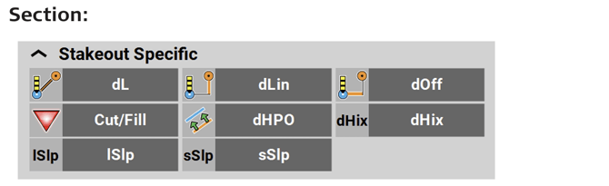
| Type/Icon | Description |
|
dL
|
Horizontal distance from the last point measured to the stakeout/layout point. |
|
dLin
|
Perpendicular distance from the last point measured to the north heading at the stakeout/layout point. |
|
dOff
|
Perpendicular distance from the last point measured to the east heading at the stakeout/layout point. |
|
Cut/Fill
|
Cut/Fill value of the last point measured, compared to the stakeout element. |
|
dHPO
|
Perpendicular height difference from the measured position to the stakeout/layout line. |
|
dHix
|
Horizontal distance to the design stakeout/lay out line. |
|
lSlp
|
Only available in Stakeout app. Indicates the long slope at the measured point. Negative means down sloping in the line direction. |
|
sSlp
|
Only available in Stakeout app. Indicates the side slope (cross slope) at the measured point to the selected line. A negative value means downward sloping from the measured point to the selected line. |


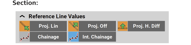
| Type/Icon | Description |
|
Proj.Lin
|
Only available in Stakeoutt and Layout Points app. Line value at measured point along the selected reference line. |
|
Proj.Off
|
Only available in Stakeout and Layout Points app. Offset value at measured point to the selected reference line. |
|
Proj. H. Diff
|
Only available in Stakeout and Layout Points app. Height difference at measured point to the selected reference line. |
|
Int. Chainage
|
Chainage at the measured point along the selected reference line, without station equation. |
|
Chainage
|
Chainage at the measured point along the selected reference line, including the station equation. With no reference line, the value shows the chainage at the measured point along the selected line. |


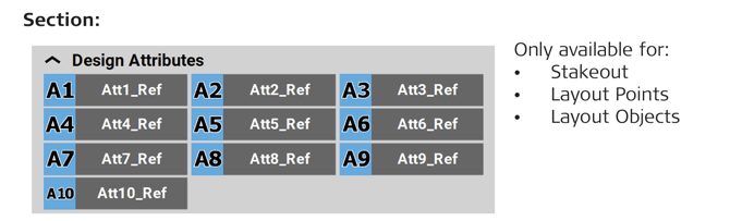
| Type/Icon | Description |
|
Att1_Ref ... Att10_Ref
|
Design attribute 1 to 10 of the reference point. Up to 10 attributes can be defined. |
| Type/Icon | Description |
|
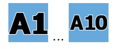
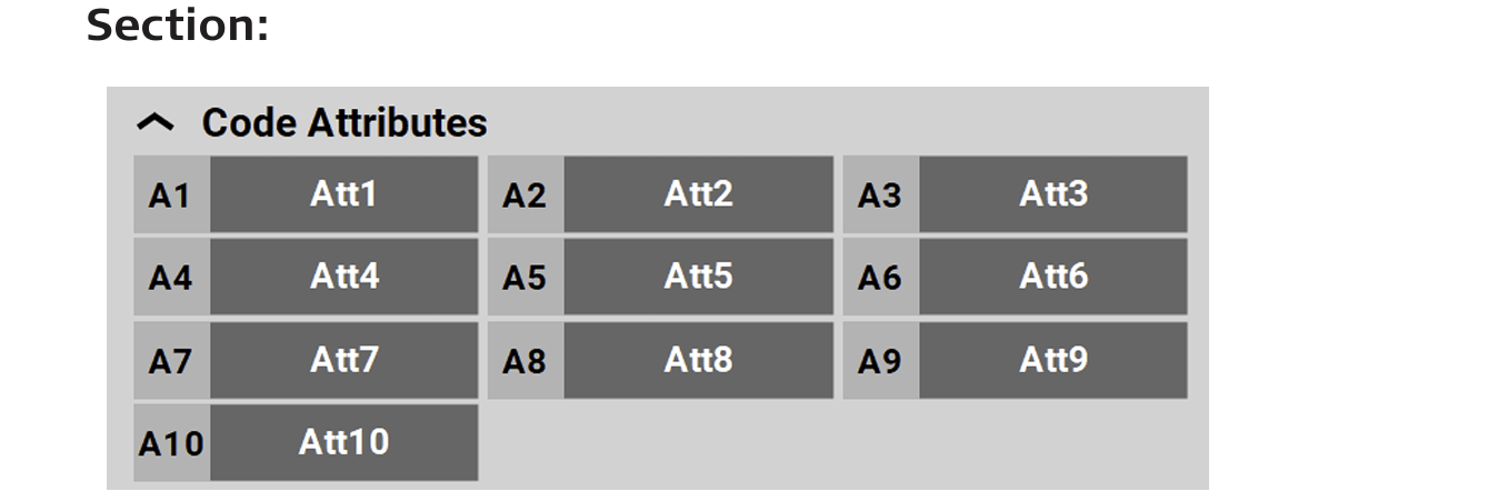
Att1 ... Att10
|
Code attributes 1 to 10 of measured point. Up to 25 attributes can be defined, up to 10 attributes can be displayed in the Information bar. |