Description
The geometric scale factor is used to correct distances for the distortion introduced by the use of a map projection.
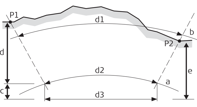
P1, P2 - Known points
d1 - Ground distance
d2 - Ellipsoid distance
d3 - Grid distance
a - Sea level
b - Elevation, 1000 m
c - Height Scale factor
d - Map Projection Scale factor
e - Combined Scale factor
Relation of ground distance to grid distance:
• Scale to central meridian and distance from central meridian defines the Map Projection Scale factor, while the height above reference defines the Height Scale factor.
• Both, the map projection and height scale factors define the PPM scale factor.
How to set the Geometric Scale Factor [TPS]
The geometric scale factor can only be set when creating a project.
Input the desired value under Geometric Scale.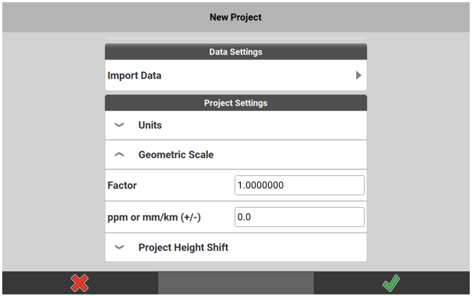
You can input either the Factor or the ppm or mm/km (+/-) value. If a scale factor is entered, the ppm value will be updated accordingly and vice versa.
The entered scale factor value affects only all Total Station measurements, GNSS measurements are not affected.
An additional icon is displayed in the Status Bar, when a geometric scale factor is applied to a project.