| App icon | App name | Availability/ Description |
 |
Coordinate System GNSS |
iCON site iCON build |
iCON site
The app is by default available on the Home screen.
iCON build
The app can be accessed by tapping the Coordinate System key from within the Function bar or the Application key.
See also: Function bar/Default Map View
The following options are available:
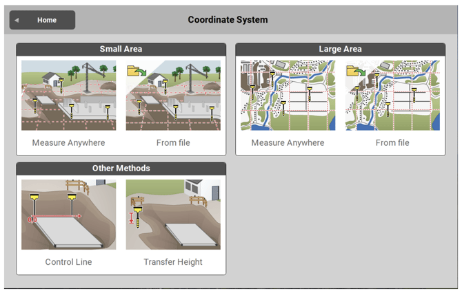
- Measure Anywhere in a Small Area (< 10 km2)
- Measure Anywhere in a Large Area
- About differences in methods see: Create a new Coordinate System step-by-step
- iCON site
- From file in a Small Area (< 10 km2)
- From file in a Large Area
- For further information see: Create Coordinate System from imported Control File
- Other Methods:
- To define a Control Line
- For further information see: Create Coordinate System by defining a Control Line
- To Transfer Height
- For further information see: Create Coordinate System using Height Transfer
- To define a Control Line